Merging Rainier's and St Helens' Drainage: Confluence of the Toutle and Cowlitz
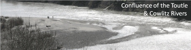
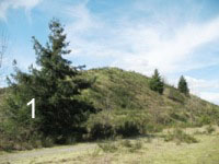
The 1980 eruption of Mt St Helens produced significant disruptions far from the volcano. Chief among these was choking of the Toutle, Cowlitz, and Columbia Rivers with sediment deposited by lahars. Some 140 million tons of sediment entered the Columbia in the first four months after the eruption. Long-term, the sediment load of the Columbia was raised from 10 to 40 million tons/year. This sediment posed a short-term problem for navigation and a long-term problem for flooding, through reduced stream capacity. The solution to the short-term issue was aggressive dredging, the products of which can still be seen at the mouth of the Toutle River (fig.1). Figure 2 shows a dredge operating on the Cowlitz Riverin 1981 and Figure 3 shows the grain sizes contained in the dredged lahars.
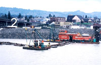
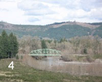
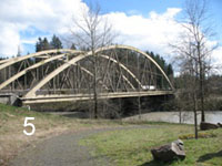
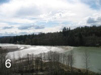
The Toutle Resort RV Park [http://www.greatrvresort.com/] has a walking trail that goes down to the Toutle River just above its confluence with the Cowlitz. Here you can see that last two highway bridges over the Toutle (fig. 4 and 5), the only ones that survived the 1980 flows, a small mountain of dredge spoil, and the sand deposited by the Toutle as it meets the Cowlitz (fig. 6). This is a great jumping-off point to tour St Helens because you are staying at the nexus of downstream events.
The bridge in Figure 4 carries the old Pacific Highway. There is convenient parking at the south end, and easy access to the water. Across the river you can see new-growth alder trees, all the same size, a common feature of the 1980 lahars. A sizable pile of dredge spoil now makes up the north bank of the stream at this point. Construction of the sediment retention structure on the North Fork of the Toutle River reduced the need for dredging, but the structure is now nearly full and more dredging will likely be needed.
The big lahar from the North Fork of the Toutle nearly reached the bottom of the bridge in Figure 5. I-5 was closed to traffic for a time, but this bridge and the adjacent railroad bridge received only minor damage.
The photograph of the confluence of the two rivers (fig. 6) was taken in early spring 2011 at a time of high flow. In the summer dry season, the extent of the sand bars formed here are more apparent. The Toutle, even today, carries one of the highest sediment loads of any US river. See the table.
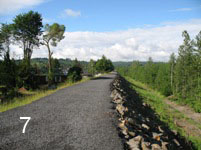
Nearby is the town of Castle Rock, which has recently had its levee system upgraded to protect against flooding (fig. 7).
Recent data on sediment yields from the Toutle, shown below, indicate that the total amount fluctuates greatly but is not declining. Sand always dominates over muc, and gravel is minor.
| Annual Sediment Load at Mouth of Toutle River | ||||
| Year | Total |
|||
M tons |
% mud |
% sand |
% gravel |
|
| 1999 | 4.88 |
45.9 | 51.4 | 2.7 |
| 2000 | 4.54 |
24.9 | 72.9 | 2.2 |
| 2001 | 0.62 |
25.8 | 72.6 | 1.6 |
| 2002 | 7.44 |
44.4 | 54.3 | 1.3 |
| 2003 | 5.26 |
45.1 | 52.3 | 2.7 |
| 2004 | 2.55 |
42.7 | 54.1 | 3.1 |
| 2005 | 2.83 |
45.9 | 51.9 | 2.1 |
| 2006 | 5.29 |
40.6 | 57.5 | 1.9 |
| 2007 | 22.75 |
40.5 | 58.7 | 0.8 |
Data Sources:
U.S. Army Corps of Engineers Toutle/Cowlitz River Sediment Budget, 2010
| http://www.nwp.usace.army.mil/docs/d_msh/Toutle-Cowlitz_sediment_budget.pdf |
U.S. Geological Survey summary of sediment loads in U.S. rivers:
http://co.water.usgs.gov/sediment/conc.frame.html#HDR3